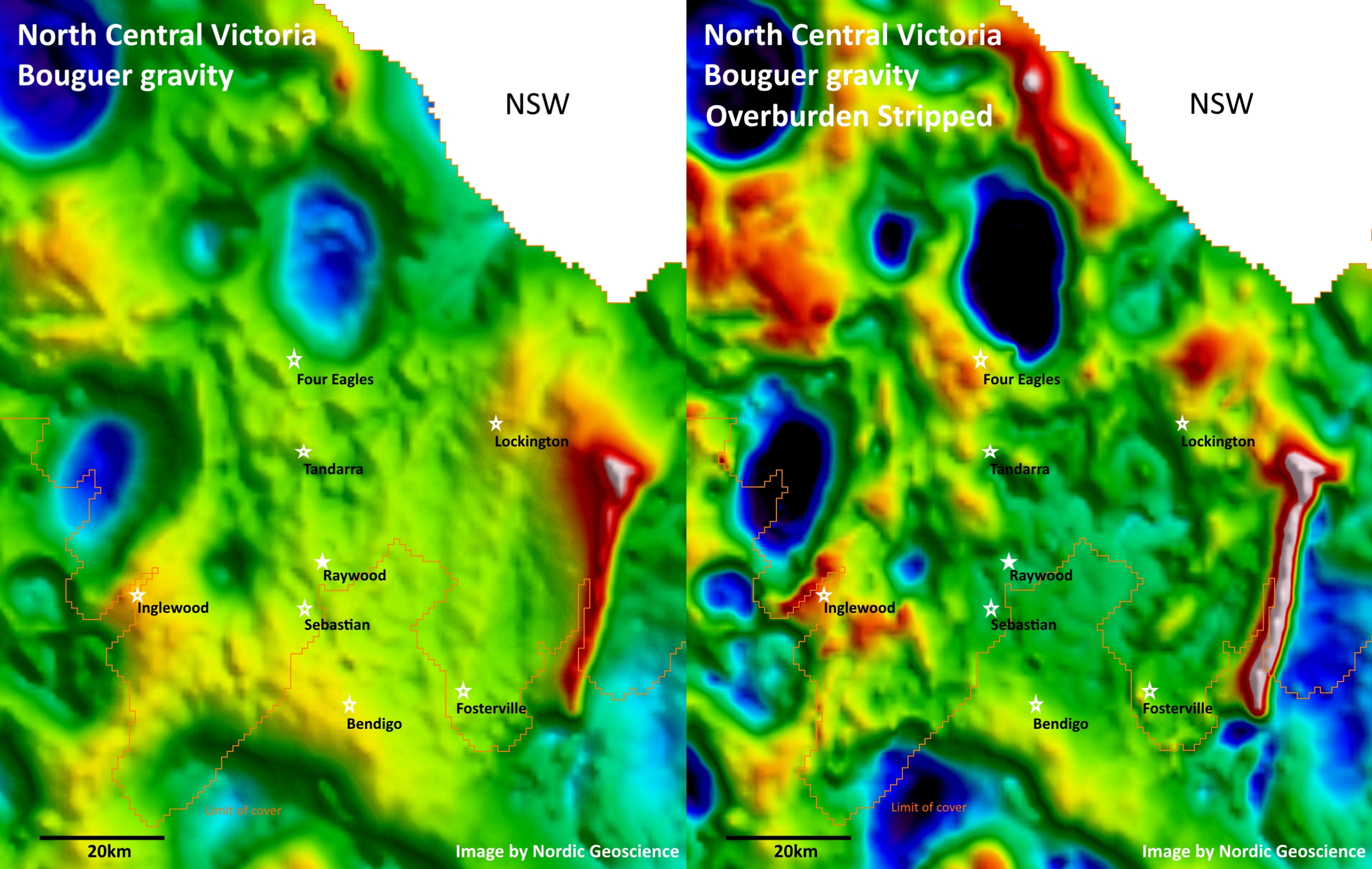
Your average gravity anomaly map contains contributions from both shallow and deep-seated geology. If you don’t have any additional constraints, then your interpretation will be ambiguous. However, if you have independent information about the near-surface cover sequence, then you can (1) model the gravity response of the overburden, (2) subtract the modelled response from the observed gravity data, and (3) thus lay bare the gravity responses from the underlying bed rock. This time-honoured technique is called “gravity-stripping”. Here is an example by Nordic Geoscience from North Central Victoria, showing both the public-domain Bouguer gravity data from Geoscience Australia, along with […]

Are there terrain effects lurking in your gravity data?
Have you used the right density in your gravity terrain correction? I once wasted two weeks doing field follow-up on a set of airborne gravity gradiometry targets. All turned out to be dusters. I later learned that a mistake had snuck into the initial processing of the airborne gravity gradient data. The gravity terrain correction had not been done as well as it possibly could have been. Needless to say, I have been slightly obsessive about gravity terrain corrections ever since. Gravity Terrain Corrections The gravity terrain correction attempts to remove the gravity effects of the surrounding hills and valleys […]
